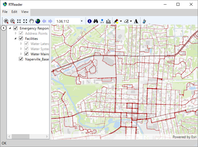
RTReader
RTReader is a free, ready-to-use app built using ArcGIS Runtime .NET
100.12 and the Runtime Extensibility Framework. It is designed to
duplicate much of the functionality, look, and feel of ArcReader. Users
already familiar with ArcReader should have little difficulty using
it.
How to Create a Map
RTReader expects a map in the form of a mobile map package. To create a
mobile map package in ArcGIS Pro, see this link:
http://pro.arcgis.com/en/pro-app/tool-reference/data-management/create-mobile-map-package.htm
[Note: there is no need to enable anonymous use. The Publisher
extension is not required to create a mobile map package for use in
ArcGIS Runtime.]
How to Open a Map Manually
Click the "Open Map..." menu:
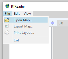
Navigate to and select the desired mobile map package.
How to Open a Map Automatically
BasicReader.xml, in the RTReader\Config folder, gives a (commented)
example of a map configuration that loads layers from multiple sources.
See the Runtime Extensibility Framework documentation for more info.
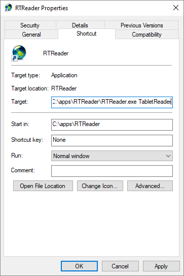
Configuration
RTReader supports configuration to change its appearance and
functionality. By default, RTReader uses the "BasicReader"
configuration. To select a particular configuration file that's in the
Config folder, create a shortcut to RTReader and add the name of the
configuration file (no .xml extension) to the target:
Return to ArcGIS Runtime page